

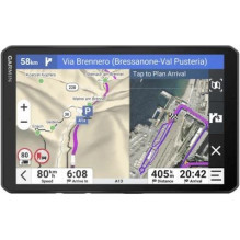
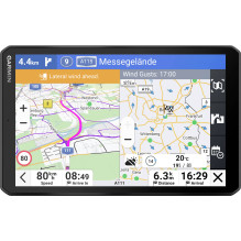
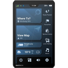
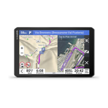
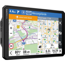
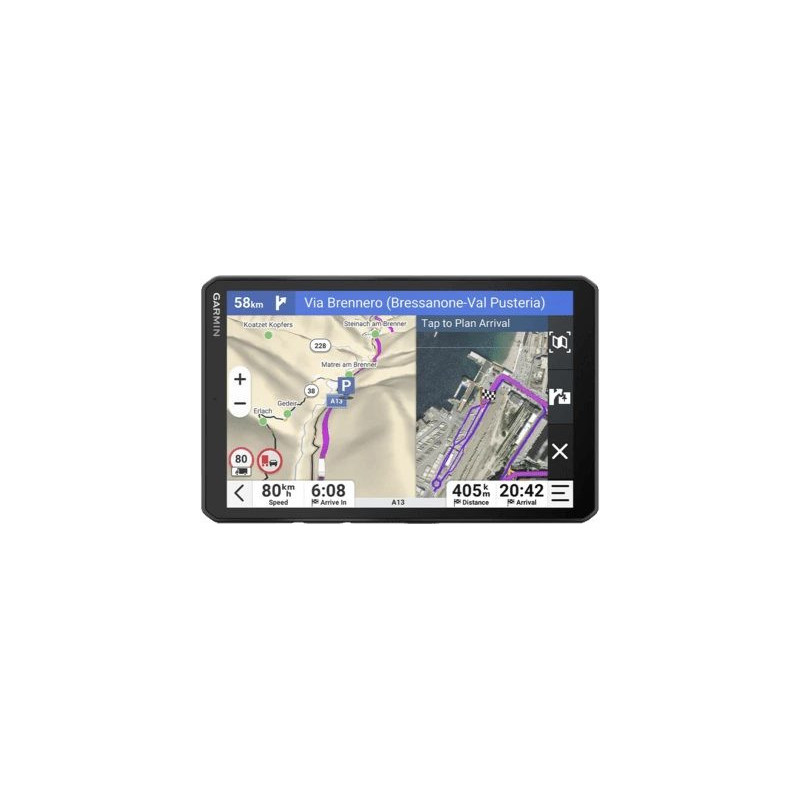

The Garmin dēzl LGV820 MT-D is a truck navigator with an 8″ (20.3 cm) touchscreen, 32 GB storage and updateable European maps. Vehicle-specific routing, arrival planning with satellite imagery, truck parking search and digital traffic information help you prepare for each journey. Some features require a compatible smartphone running the dēzl app with mobile internet access.
The Garmin dēzl LGV820 MT-D is a truck navigator with an 8″ (20.3 cm) touchscreen, 32 GB storage and updateable European maps. Vehicle-specific routing, arrival planning with satellite imagery, truck parking search and digital traffic information help you prepare for each journey. Some features require a compatible smartphone running the dēzl app with mobile internet access.
Guarantee
24 month
Delivery from Europe in
10 - 15
business days
The Garmin dēzl LGV820 MT-D is designed for journeys where vehicle dimensions, planned stops and the correct delivery entrance matter. Manufacturer code 010-02925-10 and barcode 753759335410 identify the European MT-D version, designated for the German and Swiss markets in the manufacturer's documentation.


The 8″ (20.3 cm) colour IPS TFT touchscreen has a resolution of 1280 × 800 pixels. Choose landscape or portrait orientation to suit the available cab space and your preferred route view. A split-screen route overview lets you see more journey information at once.
Enter the vehicle's height, width, length, weight and hazardous materials information so the navigator can use these details when selecting more suitable roads. Alerts for sharp curves, steep gradients, speed changes and railway crossings help you prepare for demanding sections ahead.
Popular truck paths used by other drivers provide additional context in unfamiliar areas. Environmental zone information helps you assess restrictions along your route.
BirdsEye Direct satellite imagery helps you inspect loading docks, truck entrances and security gates before arrival. When paired with the dēzl app, satellite imagery downloads automatically during arrival planning. This is useful at large logistics sites where a street address may not identify the appropriate access point.
dēzl community ratings and shared delivery locations help you choose stops and find relevant destinations. Truck Parking Europe lets you search for truck parking and filter locations by amenities such as showers or security level. Viewing availability information and ratings requires the paired dēzl app and a Truck Parking Europe account; this feature operates in Europe.
Break planning provides rest reminders and helps you find upcoming stopping places. It does not replace mandatory driving and rest time records.
The MT-D version supports Garmin Digital Traffic information. Availability depends on the region and signal coverage. Pair a compatible phone over Bluetooth and use the dēzl app with an active mobile internet connection to receive live traffic and weather information and send locations found on your phone to the navigator.
A wind speed overlay and alerts help you identify potentially hazardous conditions along the route. Hands-free calling lets you make calls through your paired phone, while Garmin voice control allows location searches and navigation requests in supported languages. Voice control and phone notifications are not supported in every language; background noise can reduce voice recognition accuracy.
European map updates are included. Built-in Wi-Fi allows map and software updates without a computer. The powered magnetic mount makes attaching and removing the navigator convenient, while the supplied mounting options help you adapt installation to your cab.
The separately sold Garmin BC 50 wireless backup camera is supported. It displays the area behind the truck on the navigator and can assist when manoeuvring.
| Parameter | Value |
|---|---|
| Manufacturer and model | Garmin dēzl LGV820 MT-D |
| Manufacturer code | 010-02925-10 |
| Barcode | 753759335410; EAN-13: 0753759335410 |
| Display | 8″ (20.3 cm), IPS TFT, capacitive touchscreen |
| Display resolution | 1280 × 800 pixels |
| Internal storage | 32 GB |
| Memory card | microSD, not included |
| Map coverage | Europe, updates included |
| Wireless connectivity | Wi-Fi, Bluetooth |
| Dimensions as specified | 200 × 125 × 20 mm |
| Device weight | 405 g |
| Battery capacity | Rechargeable lithium-ion; up to 2 hours of operation |
| Colour | Black |
Vehicle-specific routing and warnings depend on available map data and are not available everywhere. Always follow posted road signs and actual road conditions. Live services depend on connectivity and regional availability, and mobile data charges may apply. Install the device where it does not obstruct your view of the road, and read notifications only when safely stopped.