


Nešiojamas jūrinis GPS navigatorius
Nešiojamas jūrinis GPS navigatorius
Guarantee
24 month
Delivery from Lithuania in
2 - 5
business days
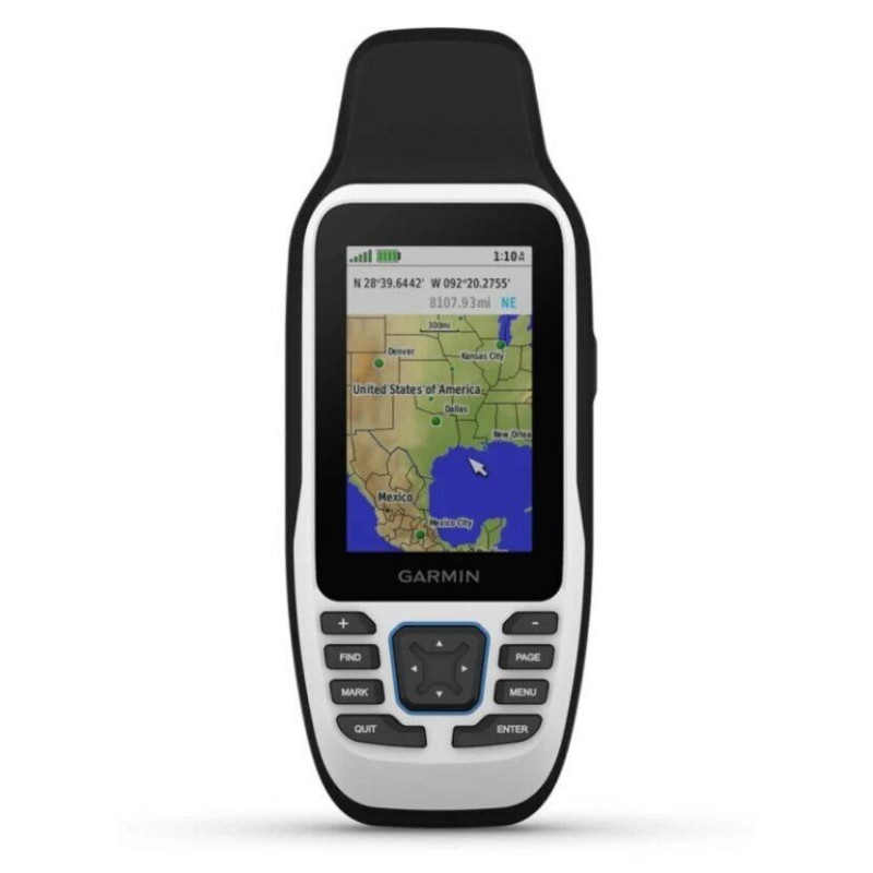
The rugged and durable GPS navigator GPSMAP 79s is designed for marine use. This GPS receiver has a 3-axis compass, barometric altimeter, bright and color LCD display, sensitive GPS receiver, microSD™ card slot for additional maps, data output connector NMEA 0183, RS232. There are rubber bands on the sides of the case, so you can hold it securely in your hands. This navigator will not sink, but float on the surface of the water.
The GPSMAP 79s comes with a built-in worldwide map (this map is large-scale and not suitable for navigation functions). Like all GPSMAP navigators, it is waterproof, and the GPSMAP 79s is also unsinkable and floats on the surface of the water.
The GPSMAP 79s has a 3-axis compass with tilt compensation, which will show you your direction even if you are not moving and holding the navigator in a non-horizontal position. This portable navigator also features a barometric altimeter that will show changes in air pressure and show your current elevation. The GPSMAP 79s features a barometric altimeter that can display pressure changes over time to help you track weather changes.
The GPSMAP 79s can share waypoints, tracks, routes, and caches with other compatible Garmin GPS navigators. That way, your friends can also share your favorite route or cache—just tap “Send” to transfer the data to their compatible devices.
With a sensitive GPS receiver with WAAS/EGNOS and HotFix® satellite positioning technology, the GPSMAP 79s quickly and accurately determines your position and maintains reliable connectivity in forested or mountainous terrain.
The microSD™ card slot and 8 GB of internal memory allow you to use a variety of maps: topographic maps for hiking, pre-loaded BlueChart® g2 maps for seas and lakes, or City Navigator® for driving on the road.
Attention! If you plan to travel a lot in Lithuania, we recommend that you purchase a detailed Lithuanian road map or Lithuanian TOPO Offroad maps together with this navigator. More information about them can be found here and here. The Lithuanian road map has a much larger database of addresses and points of interest. Together with the Lithuanian road map, this navigator will be a great helper when driving on Lithuanian roads. The Lithuanian TOPO Offroad map is a great helper when driving on forest and field roads.
After your trip, you can save and analyze your trip information thanks to the free Garmin program Garmin Connect ™. Simply connect the GPS receiver to a computer (with Internet access) using a USB cable. You can analyze navigation data in detail, save your tracks, and track your trip in Google™ Earth. Explore with millions of other Garmin users and share your experiences on Twitter and Facebook
The GPSMAP 79s supports the Geocaching GPX point format, so you can easily upload Geocaching data files from the OpenCaching.com website. Get rid of paper maps and notes, so you will not only protect nature, but also search for "treasures" more efficiently. The GPSMAP 78s GPS receiver will save all the information - coordinates, terrain, difficulty level, tips and descriptions. Just upload the GPX format data and travel.
| MEMORY / HISTORY | 8 GB |
| Water resistance | IPX7 |
| BATTERY LIFE | Up to 19 hours |
| SCREEN SIZE | 38 x 63 mm |
| SCREEN RESOLUTION | 240 x 400 |