


Guarantee
24 month
Delivery from Lithuania in
2 - 5
business days
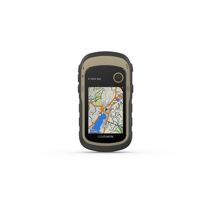
The Etrex 32x is a very popular An improved version of the Garmin portable navigator Etrex 30x. This model has an improved LCD screen, increased internal memory, so you can load larger maps. Etrex 32x has the same convenient control, reliability as the entire Etrex navigator family. This navigator can be used in all areas - when riding an ATV, cycling, sailing a boat, driving a car or even a hot air balloon. Etrex 30x is powered by AA batteries, they are enough for more than a day of work and they are easily replaced.
Etrex 30x has an improved, 2.2-inch, color (65K colors) screen, which is perfectly visible even on a sunny day. Easy-to-use and waterproof portable navigator will reliably guide you even in the worst weather conditions. It is resistant to dust, dirt, increased humidity and water.
The etrex 32x has a 3-axis compass with tilt compensation, which will show the direction even if you are not moving and hold the navigator in a non-horizontal position. This portable navigator also has a barometric altimeter, which will show changes in air pressure and show your altitude. The etrex 32x screen can display graphs of pressure changes over time to monitor weather changes.
The etrex 32x has a wide range of mounting accessories. You can mount the navigator on an ATV, bicycle, boat, car or even a hot air balloon. With the car mount and the City Navigator® Europe map loaded, you can see navigation instructions on the screen while you drive. There is also a sturdy mount for ATVs and motorcycles. Wherever you think of using the Etrex 32x, you will always find the right mount or navigation map.
The Etrex series navigators are the first to receive GPS and GLONASS satellite signals simultaneously. This way, the navigation receiver is ready for navigation approximately 20% faster.
The microSD™ card slot and 8 GB of internal memory allow you to use a variety of maps: topographic maps for hiking, pre-loaded BlueChart® g2 cards for seas and lakes or City Navigator® for driving on roads. The etrex 32x also supports BirdsEye™ satellite maps (additional subscription), so you can upload satellite images and integrate them with maps.
Note! If you plan to travel a lot in Lithuania, we recommend purchasing a detailed Lithuanian road map or Lithuanian TOPO Offroad maps along with this navigator. More information about them can be found here and here. The Lithuanian road map has a much larger database of addresses and points of interest. Together with the Lithuanian road map, this navigator will be a great helper when driving on Lithuanian roads. The Lithuanian TOPO Offroad map is a great helper when driving on forest and field roads.
The eTrex 32x can share waypoints, tracks, routes and caches with other compatible Garmin GPS navigators. That way, your friends can also share your favorite route or cache - just press "Send" to transfer the data to compatible devices.
With a sensitive GPS receiver with WAAS/EGNOS and HotFix® satellite prediction technology, the eTrex 32x quickly and accurately determines your position and maintains reliable communication in forested or mountainous terrain. The new eTrex GPS receivers also support the Russian GLONASS satellite system, which increases position detection by up to 20%.
The Etrex 32x supports the Geocaching GPX point format, so you can easily load Geocaching data files from the OpenCaching.com website. Get rid of paper maps and notes, so you will not only protect nature, but also search for "treasures" more efficiently. The Etrex 32x GPS receiver will save all the information - coordinates, terrain, difficulty level, tips and descriptions. Just load the GPX format data and travel.
With the help of the free Garmin program BaseCamp ™, you can see the maps on the navigator on your computer screen, create your own route, waypoints and tracks. You can also share your trip data with family and friends using the Garmin Adventures app. The BaseCamp app can display topographic maps in 2D and 3D mode, contour lines and elevation profiles. With a BirdsEye subscription, you can upload unlimited satellite images.